
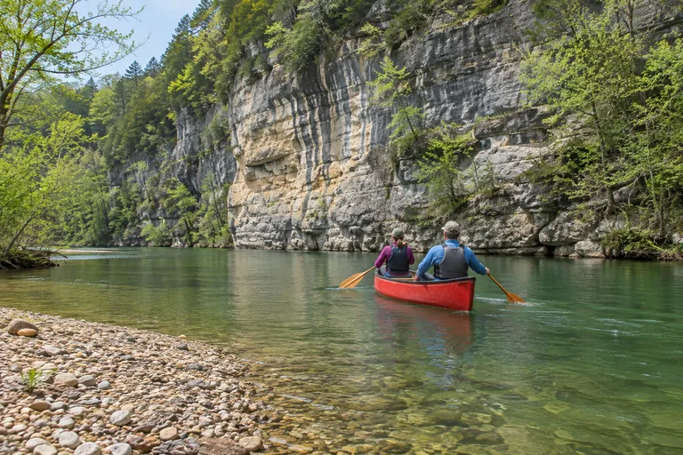
The Buffalo National River flows freely for 135 miles through the Arkansas Ozarks, and in 1972 it became the first national river in the country. Most visitors come to float it by canoe or kayak, hike to waterfalls and camp on its gravel bars. Spring is the best time to float the upper river. The lower river, near Buffalo Point, can be paddled all year.
This guide explains how a Buffalo River float trip works and when to go. It also covers the top hikes, the campgrounds, elk watching and a weekend plan. It is part of the Arkansas travel guide, which covers the rest of the Ozarks and the state.
Buffalo National River at a Glance
The park is long and narrow, with no road along the river. These facts help with planning before choosing a district.
| Topic | Detail |
|---|---|
| Location | Ozark Mountains, northern Arkansas; headquarters in Harrison |
| Established | 1972, the first national river in the United States |
| Length protected | 135 free-flowing miles, one of the few undammed rivers left in the lower 48 states |
| Protected land | More than 95,000 acres, including three wilderness areas |
| Trails | More than 100 miles of maintained trails |
| Main activities | Floating, hiking, camping, fishing, elk watching, stargazing |
| Night sky | International Dark Sky Park since 2019 |
| Canoe rentals | From park-authorized outfitters just outside the park |
Contact: Buffalo National River, 402 N. Walnut St., Suite 136, Harrison, AR 72601 (mailing address). Phone: 870-439-2502. Web: nps.gov/buff. In an emergency, the park's 24-hour dispatch is 1-888-692-1162.
The Three Districts of the Buffalo River
The park splits the river into three districts, and each one feels different. Picking a district first makes every other choice easier.
| District | Stretch | Character | Best season to float |
|---|---|---|---|
| Upper | Boxley to Carver (Ponca and Jasper area) | Narrow and fast, with whitewater, Big Bluff and the Ponca Wilderness | Spring, when rain keeps the water up; use peaks in April and May |
| Middle | Carver to South Maumee (Tyler Bend area) | Tyler Bend Visitor Center, homesteads and free primitive camping areas | Late spring and summer; use peaks in June and July |
| Lower | North Maumee to Buffalo City (Buffalo Point area) | Buffalo Point, the ghost town of Rush and the Lower Buffalo Wilderness | All year; use peaks in June and July |
The upper river holds the famous bluffs and waterfalls, but it needs rain to float well. When the upper river runs low, the middle and lower districts keep the season going. Ask an outfitter which stretch suits the day's water and the group's skill.
Buffalo River Float Trip Guide
A float trip is the classic way to see the Buffalo. The park says trips range from a few hours to several days and from 1 mile to 130 miles. Most visitors float 8 miles or less, which leaves time to swim, fish and explore gravel bars.
How Rentals and Shuttles Work
There are no rentals inside the park. Canoes, kayaks and rafts come from park-authorized outfitters just outside it. Many also run shuttles for an extra fee, so floaters can paddle one way and find their car waiting. The park publishes its list of authorized outfitters online, and the list is not an endorsement. Arkansas Tourism lists outfitters such as these:
- Buffalo Outdoor Center
- Buffalo Camping & Canoeing
- Buffalo River Float Service
- Buffalo River Outfitters
- Buffalo River Canoes
Buffalo Outdoor Center sits in Ponca on the upper river. It offers floats, shuttles, cabins and ziplining, along with a store and deli. Check the official site for current rental and shuttle rates.
Contact: Buffalo Outdoor Center, 4699 AR-43, Ponca, AR 72670. Phone: 870-861-5514. Web: buffaloriver.com.
Popular Float Sections
These sections are among the best known. Distances come from the National Park Service and from Buffalo Outdoor Center's float planner.
| Section | Distance | District | Highlights |
|---|---|---|---|
| Ponca to Steel Creek | 2.7 miles | Upper | A short first float; launch at Steel Creek instead when Ponca is too low |
| Steel Creek to Kyles Landing | 8 miles | Upper | Big Bluff, Jim Bluff, Granny Henderson's cabin and Hemmed-In Hollow, through the Ponca Wilderness |
| Kyles Landing to Erbie | 5.6 miles | Upper | Part of day two on the two-day Ponca to Pruitt route |
| Erbie to Ozark | 5.5 miles | Upper | Part of day two on the two-day Ponca to Pruitt route |
| Ozark to Pruitt | 2.1 miles | Upper | A short float that ends at Pruitt, near Highway 7 |
| Pruitt to Hasty | 7 miles | Upper | Welch Bluff's geologic fault, the Crow Hole swimming area, Chimney Rock Bluff |
| Carver to Woolum | Check the park's mileage chart | Middle | The park suggests it for avoiding spring crowds |
The Steel Creek to Kyles Landing float is the showpiece. The National Park Service calls it the heart of the Ponca Wilderness, with a shuttle of about 40 minutes. High clearance and four-wheel drive are recommended on Kyles Landing Road. On the Pruitt to Hasty float, Welch Bluff shows a fault where rock layers shifted about 100 feet. The Little Buffalo River joins about halfway down.
How Long a Float Takes
The park estimates the river's average flow at about 2 miles per hour. To estimate paddling time, divide the distance by two. An 8-mile float takes about four hours of paddling, plus time for lunch, swims and photos. Low water slows everything down, and floaters may need to drag boats over gravel bars.
Overnight and Multi-Day Floats
Buffalo Outdoor Center plans a popular two-day trip from Ponca to Pruitt, about 23.9 river miles. It suggests splitting it like this:
- Day 1: Ponca to Kyles Landing, about 10.7 miles, past Big Bluff and Hemmed-In Hollow.
- Night: camp on a gravel bar at least half a mile from a designated campground.
- Day 2: Kyles Landing to Pruitt, about 13.2 miles, through Erbie and Ozark.
If the water is low at Ponca, the outfitter suggests launching at Steel Creek, which trims the trip to about 21.2 miles. Launch early and keep daily mileage modest when the river is slow.
Best Time to Float the Buffalo River
The best time to float the Buffalo River depends on rain more than on the calendar. The park says peak river use begins in April and ends in August. Arkansas Tourism calls spring the most popular season, when rain swells the upper river into whitewater.
- Spring: the upper river usually opens first. This is the season for the Ponca to Kyles Landing stretch.
- Summer: the season moves downstream as the upper river drops. Early mornings and midweek days are calmer.
- Fall: cooler days, elk season in Boxley Valley and quiet gravel bars. The lower river is the most reliable choice.
- Winter: the lower district near Buffalo Point offers year-round paddling for well-prepared floaters.
In dry years, the season is short and shifts to the middle and lower districts. In wet years, the upper river stays floatable for most of the season.
How to Avoid the Crowds
The park says about 30% of the river carries about 70% of the canoe traffic. That leaves long quiet stretches for anyone willing to look past the famous ones. The park's own advice is short:
- Float on weekdays in spring.
- Choose a lower stretch, such as Carver to Woolum.
- In summer, go early in the morning or midweek.
The park also asks paddlers to slow down at narrow chutes and bends, where boats bunch up.
Check the River Level First
Water levels change daily. Before any trip, check the park's real-time Float Guide or the USGS gauges. The park lists these levels as unsafe for floating:
| Gauge | Unsafe above |
|---|---|
| Ponca | 1,600 cfs |
| Pruitt (Highway 7) | 2,000 cfs |
| Grinders Ferry (Highway 65) | 8,000 cfs |
| Dillards Ferry (Highway 14) | 9,370 cfs |
Thunderstorms upstream can raise the river fast, even without rain at the put-in. If a level looks borderline, call the park or ask the outfitter before launching.
River Safety for Families
The Buffalo is friendly to beginners when it is respected. The park's paddling rules are short and worth following:
- Life jackets: everyone in a boat must have one, and children 12 and under must wear theirs at all times. The park recommends that everyone wear one.
- Borrow a life jacket: the park runs a life jacket loaner program.
- Tubes: keep tube trips to 1.5 miles or less. A life jacket is not required on a tube, but the park strongly recommends one.
- Sweepers and strainers: steer clear of fallen trees in the current, which can flip a boat.
- Pinned boats: do not try to free one; report it to a ranger.
- Clothing: in fall, winter and spring, wear wool, synthetics or a wetsuit, not cotton.
- Gear: pack it in dry bags, tie it in, and wear sturdy shoes in case of a hike out.
- Plans: leave an itinerary with someone at home. Cell service is unreliable in the park.
Buffalo River Hikes
The park has more than 100 miles of maintained trails. Trails open to horses are marked in yellow, and foot-only trails in white. Bikes are not allowed on any park trail. These Buffalo River hikes range from family strolls to steep wilderness climbs.
| Hike | Distance | Difficulty | Highlight |
|---|---|---|---|
| Lost Valley to Eden Falls | 1.2 miles one way | Easy to moderate | Natural Bridge, Cob Cave, 53-foot Eden Falls |
| Compton to Hemmed-In Hollow | About 5 miles round trip | Extremely steep and strenuous | A waterfall of nearly 210 feet |
| Centerpoint to Big Bluff | About 5 miles round trip | Strenuous | The narrow Goat Trail across Big Bluff |
| Tyler Bend campground trails | Check with the park | Check with the park | Spring Hollow, Buck Ridge and Rock Wall trails; dogs allowed |
| Indian Rockhouse Trail | Check with the park | Check with the park | A Lower District trail in the Buffalo Point area |
Lost Valley Trail
Lost Valley is one of the most popular trails in the park and the best family hike. It starts near the Boxley Valley Historic District off Highway 43, about 28 miles south of Harrison. The park rates it easy to moderate, with benches along the first part. Along the way:
- The trail winds up a box canyon under groves of American beech.
- The Natural Bridge has an 8-foot waterfall pouring from an opening in the bluff into an emerald-blue pool.
- Stone steps climb to Cob Cave, a massive bluff shelter about 200 feet across.
- Eden Falls cascades 53 feet down the cliffs, 1.2 miles from the trailhead.
A rugged, steep spur climbs past Eden Falls to the mouth of a cave with a 25-foot waterfall inside. A flashlight and some agility are needed, and the park urges extreme caution. Lost Valley is day use only, with a pavilion and flush toilets. Drinking water is available from March through October.
Hemmed-In Hollow
Hemmed-In Hollow Falls drops nearly 210 feet. The park calls it the highest waterfall between the Rockies and the Appalachians. From the Compton Trailhead, the trail descends nearly 1,400 feet in about 2.5 miles, and the climb back out is about 1,200 feet. It is extremely steep and strenuous. The falls flow only after considerable rain, so plan this hike after a wet spell.
Big Bluff and the Goat Trail
From the Centerpoint Trailhead, the trail drops nearly 1,300 feet toward the river, about 5 miles round trip. A side path called the Goat Trail crosses the face of Big Bluff. The park describes it as narrow and dangerous, so it is not a hike for young children. Stay well back from bluff edges.
Buffalo River Trail
The Buffalo River Trail is the park's main trail for backpackers, since backcountry camping is allowed along it. It includes a section between Ponca and Steel Creek, where dogs are allowed. Plan a full day for any wilderness hike, and carry a detailed topographic map, since the Ponca Wilderness has many trail junctions.
Horseback Riding
Riders have plenty of room here. Arkansas Tourism says more than 75 miles of the park's trails are open to horses. Look for the yellow blazes. Steel Creek has 14 horse campsites, and Erbie has a separate horse camp.
Camping on the Buffalo River
Campers can choose between developed campgrounds and the river's gravel bars. Most campgrounds require reservations on Recreation.gov from mid-March through mid-November. Most sites can be booked up to six months ahead. Check the official site for current nightly fees.
| Campground | District | Sites | Good to know |
|---|---|---|---|
| Steel Creek | Upper | 26 walk-in tent sites, 14 horse sites | No showers or hookups; below Roark Bluff |
| Kyles Landing | Upper | 33 walk-in tent sites | No showers; rough access road |
| Erbie | Upper | 13 drive-in, 13 walk-in, 5 group sites | No showers, hookups or dump station |
| Ozark | Upper | 30 sites | No showers, hookups or dump station |
| Carver | Upper | 8 walk-in tent sites | Seasonal water, vault toilet |
| Tyler Bend | Middle | 27 drive-in, 10 walk-in, 5 group sites | No RV hookups; dump station in season |
| Buffalo Point | Lower | 80 drive-in, 21 walk-in, 5 group sites | Electric and water hookups at drive-in loops |
| Rush | Lower | 12 walk-in tent sites | Can be cut off when Rush Creek runs high |
| Spring Creek | Lower | 12 tent sites | Primitive, no water, no fee |
- Winter camping: Steel Creek and Kyles Landing switch to free, primitive, first-come camping in winter. Buffalo Point's B Loop stays open, with flush restrooms but no hookups.
- Buffalo Point change: from March 15, 2027, reservations will be required for all of its campsites.
- Middle District: Mt. Hersey, Woolum, Grinders Ferry, Gilbert and South Maumee offer free, first-come primitive camping.
- Self-pay stations: they take cash or checks only, and no change is available.
Gravel Bar Camping
Camping on a gravel bar is one of the great Buffalo River experiences. The park allows backcountry camping along the river, and floaters may build fires on gravel bars. Buffalo Outdoor Center notes that park rules require camping at least half a mile from a designated campground. Pull boats up above the tent site, not at the waterline, since a rising river can carry them off overnight. Pack out all trash and take apart any fire ring before leaving.
For more on cabins and camping styles across the country, see the cabin camping guide.
Elk Watching in Boxley Valley
Rocky Mountain elk live along the upper river, and the Boxley Valley Historic District near Ponca is the best place to see them. Buffalo Outdoor Center says elk tend to feed in the fields along the river near Ponca and through Boxley Valley.
- Best times of day: just after sunrise and again in the late afternoon.
- Best season: fall, when bulls bugle and spar during the rut, which runs through late October.
- Etiquette: pull well off the road, never approach the elk and pick up any litter.
The park also lists black bears, feral hogs and raccoons among the animals backcountry travelers should know about. Store food properly at every campsite.
Stargazing at an International Dark Sky Park
The Buffalo National River became an International Dark Sky Park in 2019, the first park in Arkansas to earn that status. Arkansas Tourism notes that the Milky Way is often visible over the river corridor. Rangers lead night sky programs at Buffalo Point and Tyler Bend in summer. A clear night on a gravel bar, far from town lights, may be the best show of the trip.
Fishing the Buffalo
Arkansas Tourism counts more than 60 fish species in the river. Anglers come for smallmouth bass, Ozark bass and goggle-eye. A canoe makes it easy to drift between pools and fish from gravel bars. Check state fishing license rules before casting.
What to Pack for a Buffalo River Float Trip
Outfitters rent the canoes and kayaks, and the rest is up to the floater. Buffalo Outdoor Center's overnight checklist and the park's safety advice cover these basics:
- Dry bags: for clothes, food and a waterproof case for a phone or camera.
- Safety gear: a first aid kit and basic rescue gear.
- Clothing: quick-dry layers, rain gear and sun protection. Skip cotton in cool months.
- Footwear: sturdy shoes that can get wet and still handle a hike out.
- Water: plenty to drink, plus a filter for overnight trips.
- A map: a Buffalo National River map, since phones lose signal.
- Overnight gear: a tent or hammock, sleeping gear and food.
Keep the load low and balanced in the boat. The park also advises securing gear in waterproof bags and tying it down.
The Buffalo River for Families and Couples
The river suits both groups, but the best plan depends on who is in the boat.
With Kids
- An easy first hike: Lost Valley has benches along the first part and the Natural Bridge waterfall on the way to Eden Falls.
- A short first float: Ponca to Steel Creek is 2.7 miles when the water allows.
- Life jackets: children 12 and under must wear one, and the park loans them out.
- Junior Ranger: the park runs a Junior Ranger program for young visitors.
- Wildlife: elk in the Boxley Valley fields, best just after sunrise or in late afternoon.
- Night programs: summer ranger night sky programs at Buffalo Point and Tyler Bend.
For Couples
- The showpiece float: Steel Creek to Kyles Landing in spring, past Big Bluff.
- A night under the stars: a gravel bar camp in an International Dark Sky Park.
- A cabin base: Buffalo Outdoor Center in Ponca rents cabins near the upper river.
- A big waterfall: Hemmed-In Hollow after a good rain, for fit hikers.
- A quiet sunrise: elk watching in Boxley Valley just after first light.
Getting There and Getting Around
The park is long and narrow, and three main highways cross it. The park uses Harrison as the starting point for directions:
- Upper District (Ponca and Jasper): drive south from Harrison on Highway 7 or Highway 43.
- Middle District (Tyler Bend): drive 31 miles south of Harrison on Highway 65.
- Lower District (Buffalo Point): take Highway 65 south for five miles, Highway 62/412 east to Yellville, then Highway 14 south.
- By air: the park lists airports in Harrison, Branson and Springfield in Missouri, Northwest Arkansas and Little Rock.
- Public transport: none in the park, so a car is essential.
Three warnings from the park are worth repeating. GPS is very unreliable here and has sent visitors onto dirt roads, so carry an Arkansas highway map or park map. Some access roads are unpaved and rocky, and a high-clearance or four-wheel-drive vehicle may be needed. No road follows the river, because it floods regularly.
For a longer Ozarks road trip, the region continues north into Missouri. The Missouri travel guide covers that side of the mountains.
A Buffalo River Weekend Itinerary
This plan focuses on the upper river around Ponca, where the bluffs, waterfalls and elk are closest together. It suits couples and families with kids who can paddle.
Day 1: Waterfalls and Elk
- Morning: hike Lost Valley to Eden Falls. Bring a flashlight for the cave.
- Midday: picnic at the Lost Valley pavilion, then drive through the Boxley Valley Historic District.
- Afternoon: a short float from Ponca to Steel Creek if the level allows, or a riverside walk at Steel Creek beneath Roark Bluff.
- Late afternoon: watch for elk in the Boxley Valley fields.
- Night: camp at Steel Creek below Roark Bluff and look up at the dark sky.
Day 2: The Showpiece Float
- Morning: launch from Steel Creek for the 8-mile float to Kyles Landing, with an outfitter shuttle booked ahead.
- On the water: pass Big Bluff, Jim Bluff and Granny Henderson's cabin.
- Midday: lunch on a gravel bar. After rain, look for Hemmed-In Hollow Falls near the river.
- Afternoon: take out at Kyles Landing and ride the shuttle back.
In late summer or fall, when the upper river runs low, switch to the lower district. Camp at Buffalo Point, hike the Indian Rockhouse Trail, explore the old mining town of Rush and float the year-round lower river.
Hidden Gems on the Buffalo River
Beyond the famous bluffs and Eden Falls, these quieter spots reward curious travelers:
- The cave above Eden Falls: a 25-foot waterfall hidden inside, reached by a steep spur from Lost Valley.
- Cob Cave: a massive bluff shelter on the Lost Valley Trail that many hikers pass too fast.
- Crow Hole: a shaded swimming hole at the base of Welch Bluff, below Pruitt.
- Welch Bluff: a visible geologic fault where rock layers shifted about 100 feet.
- Rush: a ghost town on the lower river, with the Rush Mine Level Trail nearby.
- Sod Collier Homestead: an easy self-guided stop at Tyler Bend.
- Beaver Jim's Homestead: a historic homestead that the park includes in its upper district highlights, with Roark Bluff and Lost Valley.
- Sam's Throne: which Arkansas Tourism names a premier climbing spot in the Ozark Mountains.
Insider Tips for the Buffalo National River
- Check the level the night before and the morning of. The Float Guide and USGS gauges change daily.
- Go midweek in spring. The park says most traffic crowds onto about 30% of the river.
- Use a paper map. GPS is unreliable, and cell service drops out in the valleys.
- Know the dispatch number. Save 1-888-692-1162 before leaving town.
- Book campsites early. Reservations are required at most campgrounds from mid-March to mid-November.
- Bring cash or a check. Self-pay stations give no change.
- Plan by flow, not miles. Divide the float distance by two for paddling hours, then add stops.
- Pack dry bags and spare clothes. The weekend getaway packing list is a good starting point.
- Mind the take-out at Buffalo Point. The park's mileage page says the road to its launch is closed. It suggests Dillards Ferry, 1.5 miles upstream, as a take-out instead.
Plan Your Visit: Official Resources
- Park information: nps.gov/buff lists alerts, closures, camping rules and the paddling guide.
- River levels: the park's real-time Float Guide shows current flows.
- Campground reservations: book through Recreation.gov.
- Outfitters: the park's rentals and services page lists authorized canoe and kayak outfitters.
- Arkansas Tourism: statewide trip planning at arkansas.com.
Frequently Asked Questions
Where is the Buffalo National River?
It is in the Ozark Mountains of northern Arkansas. The park headquarters is in Harrison. From there, Highways 7 and 43 lead to the upper river, Highway 65 to the middle river and Highway 14 to the lower river.
What is the best time to float the Buffalo River?
Spring is the best time to float the upper river, when rain raises the water. Peak river use runs from April through August, and the season moves downstream as the upper river drops. The lower river near Buffalo Point can be paddled all year.
How long is a Buffalo River float trip?
Anywhere from a few hours to several days. The park says most visitors float 8 miles or less. The river averages about 2 miles per hour, so divide the distance by two to estimate paddling time, then add time for stops.
Can you rent a canoe inside the park?
Not inside the park. Canoes and kayaks come from park-authorized outfitters just outside its boundaries, and some also run vehicle shuttles for an extra fee. The park publishes the list of authorized outfitters on its website.
What are the best Buffalo River hikes?
Lost Valley is the most popular, an easy to moderate 1.2-mile walk to 53-foot Eden Falls. Hemmed-In Hollow, a steep 5-mile round trip from Compton, leads to a waterfall of nearly 210 feet. The Centerpoint Trail to Big Bluff is another strenuous favorite.
Can you camp on the gravel bars?
Yes. The park allows backcountry camping on the river's gravel bars, and floaters may build fires there. Camp well away from designated campgrounds and pitch tents with boats pulled up above the tent site in case the river rises.
Where can you see elk on the Buffalo River?
In the Boxley Valley Historic District near Ponca. Elk often feed in the fields along the river just after sunrise and in the late afternoon. Fall is the most exciting time, when bulls bugle during the rut.
Do kids need life jackets on the Buffalo River?
Yes. Everyone in a boat must have a life jacket, and children 12 and under must wear one at all times. The park recommends that everyone wear one, and it runs a life jacket loaner program.
Are dogs allowed at the Buffalo National River?
Yes, in campgrounds, on the river and on gravel bars, but only on certain trails. Dog-friendly trails include the Buffalo River Trail between Ponca and Steel Creek, plus the Mill Creek and Villines Homestead trails. The campground trails at Buffalo Point and Tyler Bend also allow dogs.
Is the Buffalo National River a dark sky park?
Yes. It became an International Dark Sky Park in 2019, the first park in Arkansas with that status. Rangers lead night sky programs at Buffalo Point and Tyler Bend in summer.
Planning your next U.S. getaway? Explore more destination guides, road trips, and travel tips at Vacation Getaways US. Have a question or a spot we should cover? Email us at [email protected].