
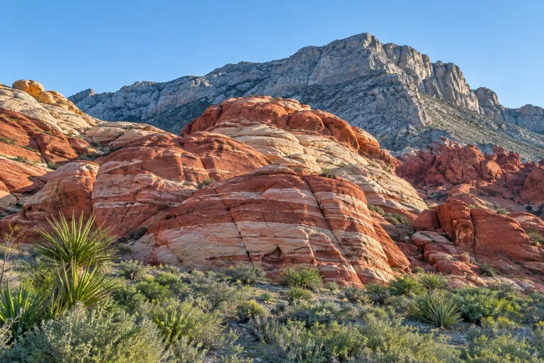
Red Rock Canyon, Nevada, is a national conservation area run by the Bureau of Land Management, about 30 minutes west of the Las Vegas Strip. Its 13-mile, one-way Scenic Drive passes red and tan sandstone cliffs, with trailheads and overlooks along the way. From October 1 to May 31, a timed entry reservation from Recreation.gov is needed to enter the Scenic Drive between 8 a.m. and 5 p.m. An entry fee or pass is also required, and there is no drinking water along the drive itself.
This Red Rock Canyon Nevada guide explains the reservation rules in the official words, then covers fees, hours and the drive from Las Vegas. It lists every trail the BLM rates, with stop-by-stop notes on the Scenic Drive. It also covers Spring Mountain Ranch State Park next door. For the rest of the state, see the Nevada travel guide.
Red Rock Canyon at a Glance
| Question | Short answer |
|---|---|
| Who runs it? | The Bureau of Land Management (BLM), Red Rock/Sloan Canyon Field Office |
| Where is it? | 17 miles west of the Las Vegas Strip on Charleston Boulevard/State Route 159, about 30 minutes by car |
| Status | Nevada's first National Conservation Area (1990), and the seventh in the country |
| Scenic Drive | 13 miles, one way, about 45 minutes without stopping |
| Reservation | Timed entry October 1 to May 31, for entry from 8 a.m. to 5 p.m.; not needed June 1 to September 30 |
| Entry fee | $20 per private vehicle (BLM, November 2026; check the official site) |
| Visitor center | 8 a.m. to 4:30 p.m. daily; the place to refill water bottles |
| Visitors | More than three million a year, according to the BLM |
Visit: Red Rock Canyon National Conservation Area, 1000 Scenic Loop Drive, Las Vegas, NV 89161 | 702-515-5350 | blm.gov, Red Rock Canyon
Red Rock Reservation: How Timed Entry Works
The Red Rock reservation is the first thing to sort out. The BLM requires timed entry reservations for the Scenic Drive from October 1 to May 31, for entry between 8 a.m. and 5 p.m. Reservations can be made at Recreation.gov, or by calling 877-444-6777. A timed entry reservation and the entry fee are also needed to reach the visitor center in that season.
The Recreation.gov timed entry page gives the details. Here is what it says today:
- Off season: reservations are not required from June 1 through September 30. Passes can be bought at the entrance station.
- When tickets open: up to 30 days in advance at 7 a.m. Pacific time, on a rolling daily window. A second batch opens two days in advance, also at 7 a.m. Pacific.
- Limit: one reservation per private vehicle or motorcycle per day, for one time slot.
- Arrival: arrive close to the time on the ticket. The page allows a 30-minute early arrival. Once inside, visitors can stay as long as the drive is open that day.
- Re-entry: "Re-entry into the Scenic Drive after your one-hour entry reservation will require a new reservation."
- Early birds: "A vehicle must be through the fee station at 8 am to be able to come in without a reservation."
- Cyclists and walkers: "A timed entry reservation is not required." This includes e-bikes and one wheels. They pay or show a pass at the entrance kiosk.
- Passes: "Annual and Lifetime passes are accepted as your entrance fee." Pass holders must show the physical pass.
- Refunds: cancel by midnight Pacific time on the day of arrival. Fees paid or passes bought on the day of arrival are not refundable.
Recreation.gov also warns that cell coverage is limited, so keep a printed or saved copy of the ticket. "Parking lots fill up early on weekends, holidays, and fee free days." Visitors arriving between 10 a.m. and 2 p.m. cannot assume every lot will be open.
Entrance Fees and Passes
Every visitor needs a daily pass or an accepted annual pass, plus the timed entry reservation in season. Fees change, so check the official site before you go. In November 2026 the BLM's planning page listed:
| Pass | Price (BLM) |
|---|---|
| Private vehicle, one day | $20 |
| Motorcycle, one day | $10 |
| Bicycle, one day | $8 |
| Pedestrian, one day | $5 |
| Children under 16 | Free |
| Red Rock Canyon annual support pass | $50 |
| America the Beautiful Annual Pass | $80 |
| Every Kid Outdoors (4th graders, with voucher) | Free |
Commercial buses, motorcoaches and vans must also reserve on Recreation.gov. They pay an extra $5 per person, not counting the driver, on arrival.
Red Rock Scenic Drive Hours
The Red Rock Scenic Drive opens at 6 a.m. every day of the year. Closing time changes by month. The BLM's January 2026 visitor guide says these hours also cover the Red Rock Overlook on State Route 159 and Red Springs.
| Months | Scenic Drive hours |
|---|---|
| November to February | 6 a.m. to 5 p.m. |
| March | 6 a.m. to 7 p.m. |
| April to September | 6 a.m. to 8 p.m. |
| October | 6 a.m. to 7 p.m. |
| Thanksgiving and Christmas Day | 6 a.m. to 12 p.m. |
The visitor center is open daily from 8 a.m. to 4:30 p.m. On Thanksgiving and Christmas it is open from 8 a.m. to 12 p.m. The BLM guide says late exit permits are available on Recreation.gov for anyone who needs to stay past closing.
Getting to Red Rock Canyon from Las Vegas
The BLM puts Red Rock Canyon 17 miles west of the Las Vegas Strip on Charleston Boulevard, which becomes State Route 159. It says the drive takes about 30 minutes. For GPS, it gives 3205 State Highway 159 for the visitor center. These are its suggested routes:
- From the Strip south of Russell Road: take I-15 south to exit 36, then Russell Road and the 215 west. Leave the 215 at exit 26 for Charleston Boulevard. Continue 5.5 miles on State Route 159 and turn right into the Scenic Drive.
- From the Strip north of Russell Road: take I-15 north to US 95, then Summerlin Parkway west. Follow the 215 south to exit 26 and Charleston Boulevard.
- From State Route 160: take I-15 exit 33 onto Blue Diamond Road west. Turn onto State Route 159 east and drive 10.5 miles to the Scenic Drive entrance on the left.
Public transportation does not serve the area. The BLM guide says to arrange any rideshare return trip before leaving the visitor center. The BLM lists these nearby services:
- Charleston Boulevard and Desert Foothills Drive: restaurants, supermarkets, gas and banks, about 4.5 miles northeast of the visitor center.
- Blue Diamond: a restaurant, gas and a small store, about 7.5 miles south on State Route 159.
- State Routes 159 and 160: a gas station, about 10.5 miles south.
Red Rock Scenic Drive: Stop by Stop
The Scenic Drive is a one-way, 13-mile loop. The BLM says it takes about 45 minutes without stopping, at an average speed limit of 35 mph. Because it runs one way, plan the stops before starting. The BLM is firm on one point: stopping along the Scenic Drive, even just to take a picture, causes accidents. Park only in the marked lots. These stops come from the BLM map, in driving order:
- Fee station and visitor center: the visitor center sits at about 3,720 feet. Stop here first for water, maps and restrooms.
- Calico I and Calico II: two lots beside the colorful Calico Hills, with access to the Calico Hills Trail.
- Sandstone Quarry: trailhead for Calico Tanks and Turtlehead Peak. Remains of the old quarry are still visible.
- High Point Overlook: a viewpoint at about 4,771 feet, with restrooms, according to the BLM map.
- Upper White Rock: reached by a short dirt road; trailhead for Keystone Thrust and the White Rock trails.
- Willow Spring Picnic Area: picnic tables, restrooms and the short Petroglyph Wall Trail. Rocky Gap Road beyond it is for 4x4, high clearance vehicles only.
- Lost Creek: trailhead for the Lost Creek Children's Discovery Trail and its seasonal waterfall.
- Ice Box Canyon: trailhead for one of the drive's harder short hikes.
- Red Rock Wash Overlook: a marked overlook on the second half of the drive.
- Pine Creek Canyon: trailhead for Pine Creek and the Fire Ecology Trail.
- North Oak Creek: reached by a dirt road near the end of the drive, then the exit onto State Route 159.
Just outside the exit, the Red Rock Overlook on State Route 159 has restrooms, picnic tables and wheelchair access. Recreation.gov notes that the vault toilets along the drive have no water.
Red Rock Canyon Hikes: Trail Table
The BLM's January 2026 visitor guide rates the trails along the Scenic Drive in three groups. Easy means little uphill and some uneven ground. Moderate means up to about 500 feet of climbing, single-digit miles, uneven ground and some rock scrambling. Difficult means a lot of uphill, possibly over 1,000 feet of climbing, and long miles or hard scrambling. All distances below are round trips from the guide.
| Trail | Trailhead | Round trip | Approx. time | BLM rating |
|---|---|---|---|---|
| Petroglyph Wall Trail | Willow Spring Picnic Area | 0.2 mi | 30 minutes | Easy |
| Fire Ecology | Pine Creek Canyon | 0.4 mi | 55 minutes | Easy |
| Lost Creek Children's Discovery | Lost Creek | 0.8 mi | 55 minutes | Easy |
| Willow Spring Loop | Willow Spring Picnic Area, Lost Creek | 1.1 mi | 1.25 hours | Easy |
| Oak Creek Canyon | North Oak Creek | 1.6 mi | 1.5 hours | Easy |
| SMYC | Lost Creek, Ice Box Canyon | 2 mi | 1.5 hours | Easy |
| Moenkopi | Visitor Center | 2.1 mi | 1.5 hours | Easy |
| Calico Tanks | Sandstone Quarry | 2.2 mi | 2 hours | Moderate |
| Arnight | Oak Creek Canyon | 2.2 mi | 1.5 hours | Moderate |
| Keystone Thrust | Upper White Rock | 2.4 mi | 1.5 hours | Moderate |
| Pine Creek Canyon and Pine Creek Loop | Pine Creek Canyon | 2.4 mi | 1 to 1.5 hours | Moderate |
| La Madre Spring | Willow Spring Picnic Area | 3.6 mi | 2 hours | Moderate |
| Knoll | Oak Creek Canyon | 3.6 mi | 2.5 hours | Moderate |
| Dale's | Ice Box Canyon, Pine Creek Canyon | 4 mi | 2.5 hours | Moderate |
| White Rock to Willow Spring | Upper White Rock, Willow Spring Picnic Area | 4.6 mi | 2.5 hours | Moderate |
| Calico Hills | Calico I, Calico II, Sandstone Quarry, Visitor Center | 6.6 mi | 1.5 to 3.5 hours | Moderate |
| Ice Box Canyon | Ice Box Canyon | 2.2 mi | 3 hours | Difficult |
| Turtlehead Peak | Sandstone Quarry | 4.6 mi | 4 hours | Difficult |
| White Rock Mountain Loop | Upper White Rock, Willow Spring, Lost Creek | 6.2 mi | 4 hours | Difficult |
| Grand Circle Loop | Visitor Center | 11.4 mi | 6 hours | Difficult |
| North Peak | Willow Spring Picnic Area | 11.8 mi | 6 hours | Difficult |
| Bridge Mountain | Willow Spring Picnic Area | 15.8 mi | 8 hours | Difficult |
The guide's advice holds for every trail: read the trail description first, check the weather, and assume a hike will take longer than expected.
Best Short Hikes for Families
- Petroglyph Wall Trail: a 0.2-mile walk across a wash to a rock panel with carvings and paintings by the area's Indigenous peoples.
- Lost Creek Children's Discovery: 0.8 mile with signs about plants and history, a stream and a seasonal waterfall.
- Fire Ecology: a steep start, then a short figure eight through ponderosa pines below the cliffs.
- Moenkopi: a 2.1-mile loop from the visitor center over a small limestone ridge with wide views.
Classic Moderate Hikes
Calico Tanks is a good step up for families with older kids. The BLM calls it a steep trail with moderate scrambling on sandstone slabs. The reward is seasonal rock pools, called tinajas, and wide views of the Las Vegas valley. Keystone Thrust climbs gently to the line where gray limestone sits on top of red sandstone. Pine Creek Canyon follows a seasonal creek toward Mescalito, a small sandstone peak in the middle of the canyon.
Big Days for Strong Hikers
Turtlehead Peak climbs 4.6 miles round trip to a summit with sheer drop-offs and loose rock near the top. Ice Box Canyon is short but rated difficult, because tricky boulder hopping leads to a seasonal waterfall. The Grand Circle Loop links several trails over 11.4 miles, and the BLM encourages GPS maps for it. Bridge Mountain, at 15.8 miles, includes steep class four scrambling to a large arch, then exposed scrambling to the summit.
Calico Basin and Red Spring
Some of the easiest walks sit just outside the Scenic Drive, in Calico Basin. The BLM says the Red Spring Picnic Area is about five minutes from the visitor center by Calico Basin Road. It also says, "No reservation or entry fee is required for the smaller picnic spots" there. The group pavilion needs a Recreation.gov reservation. Red Springs follows the same daily hours as the Scenic Drive.
The BLM guide lists these trails outside the Scenic Drive. It does not group them by rating, so the last column uses the guide's own description.
| Trail | Trailhead | Round trip | Approx. time | BLM description |
|---|---|---|---|---|
| Red Spring Boardwalk | Red Spring/Calico Basin | 0.5 mi | 30 minutes | Wheelchair accessible boardwalk |
| Ash Spring | Kraft Mountain | 1 mi | 1 hour | Easy |
| Girl Scout | Kraft Mountain | 1.3 mi | 1 hour | Easy |
| Kraft Boulders | Kraft Mountain | 1.5 mi | 1 hour | A stroll on soft sand |
| Calico Basin | Red Spring/Calico Basin | 1.5 mi | 1 hour | Easy |
| Gene's Trail | Red Spring/Calico Basin | 2.6 mi | 1.5 hours | Moderate |
| Middle Oak Creek | Middle Oak Creek | 3 mi | 3 hours | Easy |
| Kraft Mountain Loop | Kraft Mountain | 3.5 mi | 3 hours | Strenuous |
| First Creek Canyon | First Creek Canyon | 4 mi | 2 hours | Easy |
| South Oak Creek | South Oak Creek | 4.8 mi | 3.5 hours | Easy |
The Red Spring Boardwalk loops around a salt-grass meadow fed by a spring, with signs along the way. Kraft Boulders is a good place to watch rock climbers from around the world. First Creek Canyon, Middle Oak Creek and South Oak Creek start from State Route 159, south of the Scenic Drive exit.
Spring Mountain Ranch State Park Next Door
Spring Mountain Ranch State Park sits beside Red Rock Canyon, on State Route 159 south of the Scenic Drive exit. Nevada State Parks runs it, not the BLM, so it has its own fee and hours. It makes a shaded, slower-paced stop after a morning on the trails.
- Ranch house: self-guided tours of the main ranch house, with volunteers on hand. Guided tours are available by calling the park.
- History: the park describes an 1860s blacksmith shop and the Sandstone Cabin, home to the founding family.
- Picnics: tree-shaded picnic sites with tables, grills and restrooms. A group area holds up to 200 people by reservation.
- Events: living history programs run each spring and fall. Super Summer Theater presents outdoor shows from May through September.
- Trails: trails close one hour before the park closes, and visitors must stay on them.
In November 2026 the park listed an entry fee of $10 per vehicle, or $15 for non-Nevada vehicles, and $2 to bike in. Hours change by month:
| Months | Park hours (Nevada State Parks) |
|---|---|
| November to February | 8 a.m. to 4:30 p.m. |
| March and October | 8 a.m. to 6 p.m. |
| April, May and September | 8 a.m. to 7 p.m. |
| June to August | 8 a.m. to 8 p.m. |
Check the official site for the current hours and fees. A few park rules differ from Red Rock. Drones and remote-controlled aircraft are not allowed. Visitors are asked not to climb the trees, which the park says are more than 400 years old. Pets are welcome on a leash up to six feet long.
Visit: Spring Mountain Ranch State Park, 6375 Hwy. 159, Blue Diamond, NV 89004 | 702-875-4141 | parks.nv.gov/parks/spring-mountain-ranch
The Red Rock Canyon Visitor Center
The visitor center sits just past the fee station at the start of the Scenic Drive. Recreation.gov puts it plainly: "If you plan to visit the Visitor Center, plan to go there first." Here is what it offers:
- Water: Recreation.gov says flush toilets and water bottle refill stations are only at the visitor center.
- Drinks: the BLM lists a drink stand inside, open 8 a.m. to 4:30 p.m., and vending machines with bottled water near the lower restrooms.
- Exhibits: exhibits, a bookstore, and staff and volunteers to answer questions.
- Programs: the BLM guide says guided hikes and talks run daily; ask at the desk for the day's schedule.
- For dogs: water bowls outside the building.
Pets cannot enter the visitor center or its outdoor exhibits, which the BLM keeps off limits to protect its tortoises. From October 1 to May 31, reaching the visitor center needs both a timed entry reservation and the entry fee.
Best Time to Visit Red Rock Canyon
For most hikers, the cooler months from October through May are the best time to visit, with a reservation booked ahead. Summer needs no reservation, but the heat is serious. The BLM says summer highs average over 100°F, and that dehydration is common even in the cooler seasons.
| Season | What to expect (BLM) | Good to know |
|---|---|---|
| Fall (September to November) | Timed entry returns October 1; the drive closes at 7 p.m. in October and 5 p.m. from November | The campground reopens September 1 |
| Winter (December to February) | The drive closes at 5 p.m. | Desert tortoises are rarely seen from November to March |
| Spring (March to May) | Closing time moves to 7 p.m., then 8 p.m. | Timed entry runs through May 31 |
| Summer (June to August) | Highs average over 100°F (38°C) | No reservation needed; the campground is closed; hike early or late in the day |
Desert Heat and Water Safety
The Mojave Desert is a hard place to be careless. There is no drinking water on the Scenic Drive. These tips come from the BLM:
- Bring enough water: the planning page says at least one gallon (four liters) per person per day for hard activity or hot weather. The visitor guide suggests at least two liters, plus a liter per person per mile of hiking.
- Do not drink from springs: spring and creek water is not safe to drink. Only water at the visitor center and the campground is.
- Beat the heat: hike, bike or climb early in the morning or late in the evening in summer.
- Dress for the sun: a hat, layers, sunscreen and sturdy shoes.
- Watch for flash floods: avoid washes when rain is possible, and never drive through flooded areas.
- Do not rely on cell service: tell someone the plan and the time you expect to be back.
- Watch your hands and feet: rattlesnakes, scorpions and spiders hide in cracks, under rocks and in shrubs.
- Protect pets: the BLM warns that a rattlesnake bite can kill a pet, and that summer temperatures here regularly pass 110°F.
For emergencies, the BLM lists 911 or 702-293-8932.
Camping at Red Rock Canyon
The BLM runs Red Rock Canyon Campground. It is open from September 1 through May 31, by reservation on Recreation.gov, and closed from June 1 through August 31. In November 2026 the BLM listed $25 per night for a single site and $80 per night for a group site. Fees change, so check before booking.
The BLM also allows rugged dispersed camping on unpaved routes off Lovell Canyon Road all year, while spots are available. Camping is otherwise restricted in the conservation area, so stick to these two options.
Geology and History of Red Rock Canyon
The BLM guide says the rocks here tell a story that goes back more than 500 million years. It starts with limestone formed in a shallow sea, full of fossils. Then came Jurassic sand dunes, partly stained red by iron oxide. Finally, moving plates of the earth created the Keystone Thrust Fault. It is still visible as older gray limestone sitting on top of younger red and tan sandstone.
People shaped this place too. Indigenous groups managed the land for a very long time and left tools and rock art behind. A trail along old trade routes from Santa Fe to Los Angeles is now a National Historic Trail called the Old Spanish Trail. In the 1840s it carried trade goods and settlers through Red Rock Canyon. By the late 1800s, people raised livestock here and quarried sandstone at what is now Sandstone Quarry. In 1990, special legislation made Red Rock Canyon the first National Conservation Area in Nevada.
Red Rock Canyon Itineraries
Half a Day from Las Vegas
- Book ahead: reserve an early time slot on Recreation.gov, from October through May.
- Visitor center: fill water bottles, use the restrooms and pick up a map.
- Calico I or II: walk a short stretch of the Calico Hills Trail among the colorful sandstone.
- High Point Overlook: take in the view from about 4,771 feet.
- Willow Spring: walk the 0.2-mile Petroglyph Wall Trail, then finish the loop and exit onto State Route 159.
A Full Day with Spring Mountain Ranch
- Morning: hike Calico Tanks from Sandstone Quarry while it is cool.
- Late morning: stop at High Point Overlook and walk the Lost Creek Children's Discovery Trail.
- Lunch: picnic at Willow Spring.
- Afternoon: finish the drive, then turn south on State Route 159 to Spring Mountain Ranch State Park for the ranch house and a shady walk.
A No-Reservation Morning
- Before 8 a.m.: pass the fee station early, which Recreation.gov says needs no reservation, or go between June and September.
- Or skip the drive: head to the Red Spring Picnic Area in Calico Basin, where the smaller picnic spots need no reservation or entry fee, and walk the Red Spring Boardwalk.
- Afterward: continue to Spring Mountain Ranch State Park, which has its own gate and fee.
A Two-Day Las Vegas Nature Weekend
- Day 1, Red Rock Canyon: follow the full day plan above.
- Day 2, Valley of Fire: drive northeast of Las Vegas to Valley of Fire State Park, Nevada's first state park, for red sandstone, petroglyphs and short trails. Check its seasonal trail closures before going.
Hidden Gems at Red Rock Canyon
Most visitors stop at Calico I and the High Point Overlook. These quieter spots reward a little extra time:
- Petroglyph Wall: rock carvings and paintings a few minutes' walk from Willow Spring.
- Willow Spring Loop: agave roasting pits and pictographs along a rocky 1.1-mile loop.
- Fire Ecology Trail: a short walk to a stand of ponderosa pines under the cliffs.
- Ash Spring: a seasonal spring in Calico Basin where many kinds of birds are often seen.
- Dale's Trail: the BLM points hikers seeking solitude to this little-used path between Ice Box Canyon and Pine Creek.
- First Creek Canyon: a tree-lined creek outside the Scenic Drive, where the BLM says wildlife sightings are fairly common early in the morning.
- Oak Creek Canyon at sunrise: the BLM calls it a picturesque route to watch first light on the sandstone cliffs.
- Red Spring Boardwalk: a wheelchair accessible loop around a spring-fed meadow.
Insider Tips for Visiting Red Rock Canyon
- Set an alarm for 7 a.m. Pacific. Timed entry tickets open 30 days ahead, and a second batch opens two days ahead.
- Or beat the window. Recreation.gov says a vehicle through the fee station by 8 a.m. can come in without a reservation.
- Save the ticket. Cell coverage is limited, so carry a printed or downloaded copy.
- Bring the physical pass. Annual pass holders must show the card itself.
- Go to the visitor center first. It has the water refill stations.
- Plan stops before driving. The road is one way, and a return trip needs a new reservation.
- Avoid midday parking stress. Lots fill early, and between 10 a.m. and 2 p.m. not every lot may be open.
- Leave wet sandstone alone. The BLM guide says sandstone turns brittle when wet, so avoid climbing it within 72 hours after rain.
- Check holiday hours. On Thanksgiving and Christmas the drive closes at noon.
- Book the ride home first. Arrange any rideshare return before leaving the visitor center.
Rules to Know at Red Rock Canyon
- Pets: welcome on all trails, on a leash no longer than 6 feet, and never left alone in a vehicle or tied up outside.
- Wildlife: never approach burros, mule deer or bighorn sheep. The BLM warns they can cause serious injury.
- Tortoises: desert tortoises are protected. Give any tortoise space, and drive slowly.
- Springs and creeks: no swimming, wading or bathing.
- Restricted activities: target shooting, mountain biking, rockhounding, camping and off-roading are limited to certain areas or not allowed.
- Leave No Trace: stay on marked trails, pack out all trash, including pet waste, and leave rocks, plants and artifacts where they are.
Frequently Asked Questions About Red Rock Canyon Nevada
Do you need a reservation for Red Rock Canyon?
Yes, for the Scenic Drive from October 1 to May 31, for entry between 8 a.m. and 5 p.m. Book a timed entry ticket on Recreation.gov or by phone at 877-444-6777. Reservations are not required from June 1 through September 30. Cyclists and people on foot do not need one.
How much does it cost to visit Red Rock Canyon?
The BLM lists a daily pass at $20 per private vehicle, $10 per motorcycle, $8 per bicycle and $5 per pedestrian. A Red Rock Canyon annual support pass is $50, and children under 16 are free. In the reservation season, both a timed entry reservation and the entry fee or a pass are needed. Fees change, so check the official site.
What are the Red Rock Scenic Drive hours?
The drive opens at 6 a.m. all year. It closes at 5 p.m. from November through February, 7 p.m. in March and October, and 8 p.m. from April through September. On Thanksgiving and Christmas Day it is open 6 a.m. to 12 p.m.
How far is Red Rock Canyon from Las Vegas?
The BLM puts it 17 miles west of the Las Vegas Strip on Charleston Boulevard, State Route 159, or about 30 minutes by car. Public transportation does not reach it. For GPS, search Red Rock Canyon Visitor Center or 3205 State Highway 159.
What are the best Red Rock Canyon hikes for families?
Good short choices from the BLM guide are the Red Spring Boardwalk (0.5 mile, wheelchair accessible), the Petroglyph Wall Trail (0.2 mile), Lost Creek Children's Discovery (0.8 mile) and the Moenkopi loop (2.1 miles). Calico Tanks (2.2 miles) is a moderate step up with some scrambling.
Who manages Red Rock Canyon?
The Bureau of Land Management, through its Red Rock/Sloan Canyon Field Office. Special legislation in 1990 made it a National Conservation Area, the first in Nevada and the seventh in the country. Spring Mountain Ranch State Park next door is run by Nevada State Parks.
What is the best time to visit Red Rock Canyon?
Fall, winter and spring suit most hikers, with timed entry in place from October 1 to May 31. Summer needs no reservation, but the BLM says highs average over 100 degrees, so hike early. In winter the drive closes at 5 p.m., and desert tortoises are rarely seen from November to March.
Can you bring a dog to Red Rock Canyon?
Yes. The BLM says pets are welcome on all trails, on a leash no longer than 6 feet. Pets may never be left alone in vehicles or tied up outside. They are not allowed in the visitor center or its outdoor exhibits, which protect the tortoises.
Is there drinking water at Red Rock Canyon?
Only at the visitor center and the campground. The BLM says there is no drinking water on the Scenic Drive. It advises at least one gallon per person per day for hard activity or hot weather.
What is Spring Mountain Ranch State Park?
It is a Nevada state park next to Red Rock Canyon, at 6375 Highway 159 in Blue Diamond. Visitors tour the main ranch house, see an 1860s blacksmith shop and picnic in the shade. In November 2026 the entry fee was $10 per vehicle, or $15 for non-Nevada vehicles.
Ready to plan the rest of the trip? Start with the Nevada travel guide for Las Vegas, Lake Tahoe, Hoover Dam and the long desert drives between them.
Planning your next U.S. getaway? Explore more destination guides, road trips, and travel tips at Vacation Getaways US. Have a question or a spot we should cover? Email us at [email protected].